Choose bands and calibration before choosing megapixels
An agricultural camera should capture the quantities needed for the decision. Multispectral instruments measure reflectance in selected bands; thermal instruments observe emitted infrared radiation. RGB cameras add visible detail for inspection and reconstruction. More channels or more pixels can expand analysis, but they also add integration, storage, calibration and processing requirements.
The five options below include standalone payloads and DJI's integrated Mavic 3 Multispectral camera system. They represent different routes to crop imagery, rather than five interchangeable accessories. Confirm the aircraft mount and power arrangement before comparing a payload quotation with the price of an aircraft that already contains its optics.
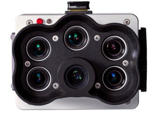
Standard RedEdge-P; Dual variants separate
MicaSense RedEdge-P
A multispectral payload combining narrow bands with a panchromatic channel for appropriate high-detail processing.
Pan-sharpening does not make native spectral sampling finer.
View product details ↗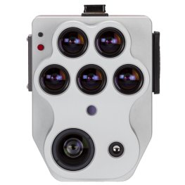
Altum-PT integrated payload
MicaSense Altum-PT
A combined sensor package for simultaneous multispectral and thermal crop observations.
Thermal and spectral layers require separate calibration and interpretation.
View product details ↗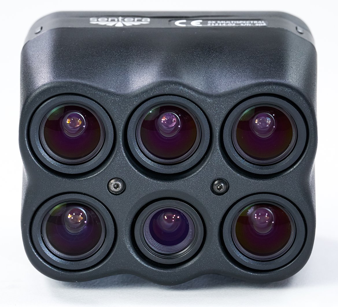
6X Multispectral; Thermal and Thermal Pro separate
Sentera 6X
A sensor family combining high-resolution visible imagery and multispectral measurements, with thermal models available.
Thermal specifications differ by variant.
View product details ↗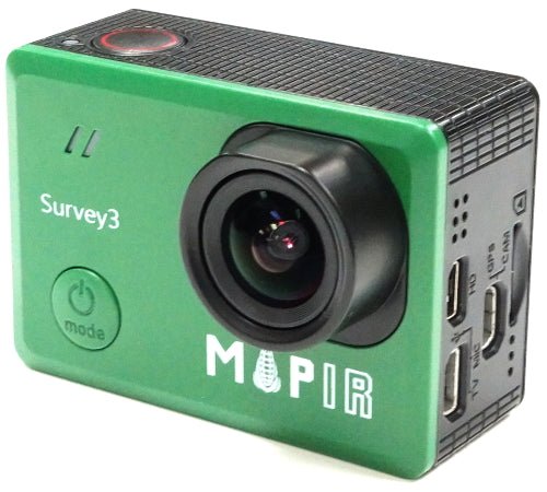
Survey3W red/green/NIR filter version
MAPIR Survey3W RGN
A compact camera offered with spectral-filter choices; the RGN version supplies red and near-infrared observations for suitable index workflows.
Several filter versions share the Survey3W name; select RGN deliberately.
View product details ↗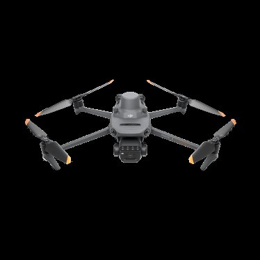
Mavic 3M integrated aircraft and camera
DJI Mavic 3 Multispectral
A folding multirotor that combines visible and multispectral sensing in one acquisition system.
Camera choice is tied to the aircraft; plan processing separately.
View product details ↗| Model | Measurement / role | Data connection | Coverage / installation |
|---|---|---|---|
| MicaSense RedEdge-P | Five multispectral bands and panchromatic imagery | Aircraft integration plus DLS 2 and reflectance-panel workflow | Flight height and processing determine band-specific GSD |
| MicaSense Altum-PT | Multispectral, panchromatic and thermal imagery | Aircraft integration with light-sensor and calibration workflow | Native ground sampling differs between channels |
| Sentera 6X | RGB and multispectral; thermal in equipped variants | Matched aircraft integration and reflectance calibration | Native channels and flight plan determine mapping detail |
| MAPIR Survey3W RGN | Red, green and near-infrared imagery | Aircraft mount and calibration workflow selected separately | Wide-angle Survey3W configuration |
| DJI Mavic 3 Multispectral | RGB plus green, red, red-edge and near-infrared imagery | Integrated camera and RTK-capable acquisition workflow | Flight altitude and image plan determine ground sampling and coverage |
Understand what each instrument supplies
MicaSense RedEdge-P combines five narrow multispectral bands with a panchromatic channel. The panchromatic data support finer-detail outputs through appropriate processing; they do not change the native information recorded by each multispectral detector. MicaSense Altum-PT adds a thermal channel alongside multispectral and panchromatic observations, making it relevant when temperature and reflectance need to be collected together.
Sentera 6X is a sensor family with multispectral and thermal configurations. Select the exact model: the presence and thermal characteristics of one version must not be transferred to another. MAPIR Survey3W is offered with several filter combinations, including red, green and near infrared. Choose the spectral variant deliberately; a visible-light Survey3W is not the same instrument as its RGN configuration.
DJI Mavic 3 Multispectral integrates an RGB camera and four multispectral cameras on a dedicated aircraft. Its compact acquisition package avoids a separate camera mount, but binds the sensing workflow to that aircraft. Evaluate the raw band images, sunlight information and processing compatibility needed by your software.
Resolution is band-specific
Check the ground sampling distance of each band at the proposed flight height. A high-resolution RGB or panchromatic channel can show structures that a lower-resolution spectral band cannot independently resolve. Pan-sharpening combines information to create a finer-grid product, but that is a processing operation with assumptions. For plot measurements, inspect the unsharpened bands and alignment as well as the attractive composite image.
Different sensors use different band centres and bandwidths. Two products labelled near infrared may sample somewhat different wavelengths, so identical index formulas can yield different values. Maintain the same instrument and calibration approach for repeat trials, or develop a documented cross-sensor comparison. Do not interpret a camera change as a crop change.
Thermal pixels also differ from visible-image pixels. Canopy temperature analysis needs enough pixels on the crop and an approach to separating foliage from exposed soil. Emissivity settings, reflected radiation, air conditions and sensor calibration affect interpretation. Thermal imagery can inform water-stress assessment, but a hot pixel alone does not measure root-zone deficit.
Calibration and installation
Use the manufacturer's reflectance panel and irradiance procedure. Keep the panel clean, level and free of operator shadow, and capture it under the conditions specified for the system. Record panel identifiers and retain the raw images. An upward-looking sunlight sensor should have the correct mounting orientation and an unobstructed view. Check aircraft vibration, trigger synchronisation, cable retention and clearance through the full gimbal movement.
Verify timestamps, camera positions and lens settings in the processing software. Spectral channels must align well enough for the size of features being analysed. A small offset can create false index edges along rows or plot boundaries. Inspect several raw bands and a processed sample before committing to a season-long workflow.
Compact multispectral cameras brought band-specific aerial analysis to small unmanned aircraft after agricultural remote sensing had already developed through airborne and satellite instruments. Modern payloads add synchronisation, irradiance measurement and integrated thermal channels. Historical camera names remain common in research papers, so match a study to its exact sensor rather than assuming a current model has identical bands.
Terms on a payload datasheet
- Reflectance
- The fraction of incident radiation reflected by a surface under defined conditions.
- Radiometry
- The measurement and calibration of electromagnetic radiation.
- Panchromatic
- A broad spectral channel used for spatial detail.
- Red edge
- The region of rapid change between red absorption and near-infrared reflectance in vegetation.
- Irradiance
- Incoming radiant power per unit area.
Questions about camera selection
Do I need thermal for NDVI?
No. NDVI uses red and near-infrared reflectance. Thermal supplies different information and a separate interpretation workflow.
Can I mount any payload on my drone?
Check supported mounts, power, triggering, mass and software. A physical fit does not establish a safe or calibrated integration.
Can I compare maps from different days?
Use consistent geometry, illumination handling and calibration. Retain raw data and metadata so that an apparent change can be investigated.